Back نهر ماهاكام Arabic نهر ماهاكام ARZ Tukad Mahakam BAN Махакам Byelorussian Махакам Bulgarian Sungai Mahakam CEB Mahakam Czech Махакам CV Mahakam German Río Mahakam Spanish
| Mahakam | |
|---|---|
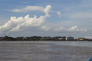
 Mahakam River at Samarinda | |
 | |
| Location | |
| Country | Indonesia |
| Province | East Kalimantan |
| Towns/Cities | Samarinda, Tenggarong, Sebulu, Muara Kaman, Kota Bangun, Melak, Long Iram |
| Physical characteristics | |
| Source | Cemaru |
| • location | Indonesia |
| • coordinates | 1°16′59.142″N 114°28′31.0296″E / 1.28309500°N 114.475286000°E |
| • elevation | 1,681 m (5,515 ft) |
| Mouth | Makassar Strait |
• location | Indonesia |
• coordinates | 0°35′6″S 117°16′33″E / 0.58500°S 117.27583°E |
• elevation | 0 m (0 ft) |
| Length | 980 km (610 mi)[1] |
| Basin size | 77,095.51 km2 (29,766.74 sq mi)[1] |
| Width | |
| • minimum | 145 m (476 ft) |
| • average | 300 m (980 ft)[2] |
| • maximum | 1,260 m (4,130 ft) |
| Depth | |
| • average | 15 m (49 ft)[2] |
| • maximum | 60.2 m (198 ft)[2] |
| Discharge | |
| • location | Mahakam Delta |
| • average | (Period: 2003–2016)4,278 m3/s (151,100 cu ft/s)[3] |
| Basin features | |
| Progression | Makassar Strait |
| River system | Mahakam River[4] |
| Tributaries | |
| • left | Melaseh, Tepai, Nyaan, Boh, Medang, Pariq, Muyub, Pela, Belayan, Telen, Kedang Rantau |
| • right | Usok, Danum Parae, Kosso, Cihar, Ratah, Kedang Pahu, Bongan, Jembayan |
Mahakam River in Kalimantan
The Mahakam River (Indonesian: Sungai Mahakam) is third longest and volume discharge river in Borneo after Kapuas River and Barito River, it is located in Kalimantan, Indonesia. It flows 980 kilometers (610 miles) from the district of Long Apari in the highlands of Borneo, to its mouth at the Makassar Strait.
The city of Samarinda, the provincial capital of East Kalimantan, lies along 48 kilometers (30 mi) from the river mouth. The delta Mahakam river consist of specific micro climate which is influenced by high and low tide at sea level.
- ^ a b PENGELOLAAN SUMBER DAYA AIR WILAYAH SUNGAI MAHAKAM (PDF). 2017.
- ^ a b c B., Vermeulen; A. J. F., Hoitink; S. W., van Berkum; H., Hidayat (2014). "Sharp bends associated with deep scours in a tropical river: The river Mahakam (East Kalimantan, Indonesia)". Journal of Geophysical Research: Earth Surface. 119 (7): 1441-1454. Bibcode:2014JGRF..119.1441V. doi:10.1002/2013JF002923.
- ^ Ting-Hsuan, Huang; Chen-Tung, Arthur Chen; Hsiao-Chun, Tseng; Jiann-Yuh, Lou; Shu Lun, Wang; Liyang, Yang; Selvaraj, Kandasamy; Xuelu, Gao; Jough-Tai, Wang; Edvin, Aldrian; G.S., Jacinto; Gusti Z., Anshari; Penjai, Sompongchaiyakul; B.J., Wang (May 2017). "Riverine carbon fluxes to the South China Sea: Riverine carbon fluxes to the SCS". Journal of Geophysical Research: Biogeosciences. 122 (5): 1239–1259. doi:10.1002/2016JG003701. S2CID 135024272.
- ^ Hukum Online. "Keputusan Menteri Kehutanan No. SK.511/MENHUT-V/2011" (in Indonesian).
